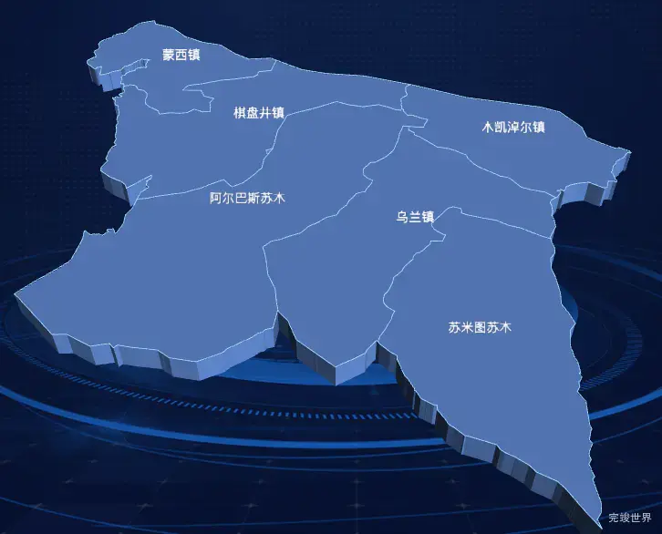
vue 数据可视化大屏项目开发中,使用echarts-gl实现3d地图时,客户对地图的颜色不满意,需要重新调配,但是设计师那边没有3d地图的设计图,又不好设计颜色,所以就想着要不做个调色板出来,让客户按照自己的喜好配置颜色吧。
3d地图
配色版
安装依赖
pnpm i lil-gui
引入
import GUI from 'lil-gui';
使用
const gui = new GUI();
    gui.addColor(that.obj, 'color1').name('地图颜色').onChange(value => {
      that.drawEcharts();
    });
    gui.addColor(that.obj, 'color2').name('边线颜色').onChange(value => {
      that.drawEcharts();
    });
    gui.addColor(that.obj, 'color3').name('鼠标移入颜色').onChange(value => {
      that.drawEcharts();
    });
    gui.addColor(that.obj, 'color4').name('文字颜色').onChange(value => {
      that.drawEcharts();
    });
    gui.add(that.obj, 'size').name('字体大小').onChange(value => {
      that.drawEcharts();
    });
完整实例代码
<template>
  <div class="item1">
    <div class="centerMap" ref="centerMap">
    </div>
  </div>
</template>

<script>

import data from '../assets/data.json'
import * as echarts from "echarts"
import 'echarts-gl'
import GUI from 'lil-gui';

export default {
  name: "item1",
  data() {
    return {
      data,
      list: [],
      myChart: null,
      obj: {
        color1: '#6089d1',
        color2: '#a9dbff',
        color3: '#ddb84c',
        color4: '#fff',
        size: 14,
      },
    }
  },
  components: {},
  watch: {},
  mounted() {
    var that = this;
    const viewElem = document.body;
    // 监听窗口变化,重绘echarts
    const resizeObserver = new ResizeObserver(() => {
      setTimeout(() => {
        that.drawEcharts();
      }, 300)
    });
    resizeObserver.observe(viewElem);
    const gui = new GUI();
    gui.addColor(that.obj, 'color1').name('地图颜色').onChange(value => {
      that.drawEcharts();
    });
    gui.addColor(that.obj, 'color2').name('边线颜色').onChange(value => {
      that.drawEcharts();
    });
    gui.addColor(that.obj, 'color3').name('鼠标移入颜色').onChange(value => {
      that.drawEcharts();
    });
    gui.addColor(that.obj, 'color4').name('文字颜色').onChange(value => {
      that.drawEcharts();
    });
    gui.add(that.obj, 'size').name('字体大小').onChange(value => {
      that.drawEcharts();
    });
  },

  methods: {
    drawEcharts() {
      var that = this;
      if (this.myChart) {
        this.myChart.dispose()
      }
      var chartDom = that.$refs.centerMap;
      var myChart = this.myChart = echarts.init(chartDom);
      myChart.clear()
      myChart.resize()
      var nameMap = '地图数据';
      // 图标数据
      echarts.registerMap(nameMap, this.data);
      var optionMap = {
        geo3D: {
          map: nameMap,
          roam: true,
          itemStyle: {
            color: that.obj.color1,
            borderWidth: 0.8,
            borderColor: that.obj.color2
          },
          emphasis: {
            itemStyle: {
              color: that.obj.color3
            },
          },
          label: {
            show: true,
            color: that.obj.color4, //地图初始化区域字体颜色
            fontSize: that.obj.size,
            opacity: 1,
          },
        },
      };
      myChart.clear()
      myChart.resize()
      myChart.setOption(optionMap);
    }
  },
}
</script>

<style lang="scss" scoped>
.item1 {
  position: relative;
  width: 100%;
  height: 100%;
  display: flex;
  justify-content: center;
  align-items: center;
  flex-wrap: nowrap;
  flex-direction: row;
  align-content: flex-start;
}

.map {
  width: 100%;
  height: 100%;
  display: flex;
  justify-content: center;
  align-items: center;
  flex-wrap: nowrap;
  flex-direction: row;
  align-content: flex-start;
  margin: 0 auto;
  position: absolute;
  z-index: 0;

  img {
    height: 100%;
    max-width: 100%;
    max-height: 100%;
  }
}

.centerMap {
  width: 100%;
  height: 100%;
  position: relative;
  z-index: 1;
  top: 0;
}
</style>


